Turkey hit by M7.8 earthquake. USGS gives 34% chance damages rise above $1bn
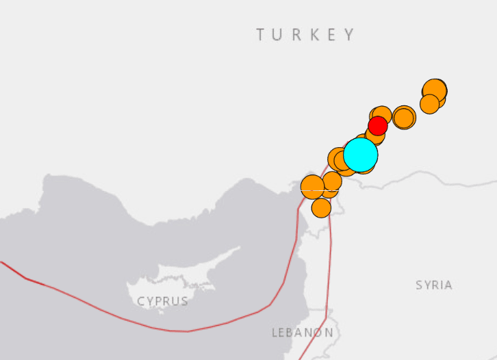
Significant fatalities and damage have been reported after Southern Turkey was struck by a major Magnitude 7.8 earthquake this morning close to Gaziantep, near the Syrian border. The US Geological Survey (USGS) gives a 34% chance that the economic impact will reach above US $1 billion.
This earthquake is one of the largest ever recorded in Southern Turkey, although the region is particularly seismically active.
The death toll is already reported to have risen above 500 people, with that figure expected to rise much higher and the USGS Pager data suggests a 47% chance more than 1,000 deaths will have occurred from the quake.
More than 1,700 buildings are reported to be damaged or destroyed in Turkey alone, according to a statement from the Vice President, with some cities particularly badly impacted.
Kahramanmaras, a city of more than 1 million people, has been hit hard, as too have Malatya, Hayat region and reports suggest up to 10 major cities heavily affected by collapsing buildings.
Northern Syria has also seen significant damage, with over 200 reported deal in the country.
The USGS said, “On February 6, 2023, a magnitude 7.8 earthquake occurred in southern Turkey near the northern border of Syria. The earthquake was followed 11 minutes later by a magnitude 6.7 aftershock. The magnitude 7.8 earthquake resulted from strike-slip faulting at shallow depth. The event ruptured either a near-vertical left-lateral fault striking northeast-southwest, or a right-lateral fault striking southeast-northwest.
“The preliminary location of the earthquake places it within the vicinity of a triple-junction between the Anatolia, Arabia, and Africa plates. The mechanism and location of the earthquake are consistent with the earthquake having occurred on either the East Anatolia fault zone or the Dead Sea transform fault zone. The East Anatolia fault accommodates the westward extrusion of Turkey into the Aegean Sea, while the Dead Sea Transform accommodates the northward motion of the Arabia peninsula relative to the Africa and Eurasia plates.
“Although earthquakes are commonly plotted as single points on a map, they rupture planes that have dimensions. A magnitude 7.8 strike slip earthquake typically ruptures a fault ~190 km long and ~25 km wide.
“Overall, the population in this region resides in structures that are extremely vulnerable to earthquake shaking, though some resistant structures exist. The predominant vulnerable building types are unreinforced brick masonry and low-rise nonductile concrete frame with infill construction.”
The USGS Pager data suggests a 34% chance economic damages will rise above US $1 billion, which would make this a very costly earthquake event for the region.
Steve Bowen, Chief Science Officer at reinsurance broker Gallagher Re, commented that a magnitude 6.7 quake in the same region in January 2020 cost around US $600 million.
Insurance penetration is rising in Turkey and there is reinsurance capital at-risk to this event. However, the majority of the economic loss from this devastating earthquake is likely to be unprotected, resulting in the loss to the insurance and perhaps reinsurance industry likely being relatively small by comparison.
Numerous aftershocks have affected the area since the main quake at 04:17 am local time, causing further damages to buildings and challenges to rescuers.
The earthquake’s epicentre was around 32km (20 miles) from Gaziantep, which is the provincial capital for the region about 26km at about 17.9km (11 miles) deep, according to the USGS.
USGS information and data related to this earthquake can be found here.