China coast including HK & Greater Bay area faces twin typhoon threats
The Chinese coastline from Shanghai right the way around to Hong Kong and the Greater Bay area is all facing a threat of potentially destructive winds and storm surge, as super typhoon Saola and what is currently tropical storm Haikui approach.
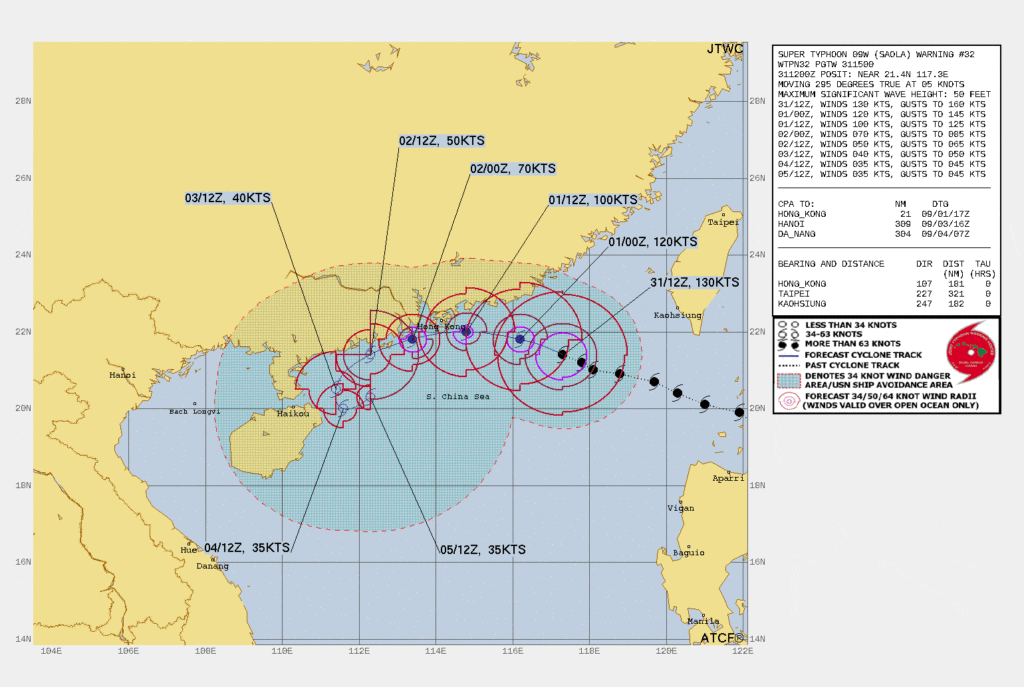
Super typhoon Saola is a really significant storm, with sustained winds currently estimated at above 155 mph and higher gusts.
Super typhoon Saola also has the potential to be one of the more significant typhoons to strike China for the global insurance and reinsurance industry, given it is on track to impact Hong Kong and the Greater Bay area of China.
This region of China has particularly high exposure concentrations, some of the highest insurance penetration, as well as massive global supply-chain relevance as well.
The latest JTWC forecast map below, shows typhoon Saola weakening to a Category 1 storm when it approaches Hong Kong first, but then moving along the coast of the Greater Bay region, so with the potential to impact major urban areas such as Shenzhen, while many other cities around the Pearl River estuary are situated in the cone of uncertainty.
As with any typhoon striking China, it is not just the wind speeds and surge that can drive economic and insurance market losses, but the heavy rainfall that is always anticipated with them.
Just recently a typhoon drove significant flooding in China after near-record rainfall. A similar occurrence in the heavily populated and high-value Greater Bay region could prove costly.
Up to 8 inches are expected with typhoon Saola, more in some isolated areas, and the Chinese authorities have activated a Level 4 emergency response for floods across six regions.
The Hong Kong Observatory said, “According to the present forecast, Saola will be rather close to Hong Kong later tomorrow (1 September) and will pose a threat to Hong Kong. The Observatory will issue the Gale or Storm Signal No. 8 between 2 a.m. and 5 a.m. tomorrow. Local weather is expected to deteriorate significantly, with heavy squally showers and violent winds, during the day tomorrow.
“Under the influence of storm surge, the water level in Hong Kong is expected to rise appreciably towards midnight tomorrow until noon on Saturday (2 September). There may be serious flooding in low-lying coastal areas. Impact of storm surge depends on the intensity and location of Saola when it skirts the territory.”
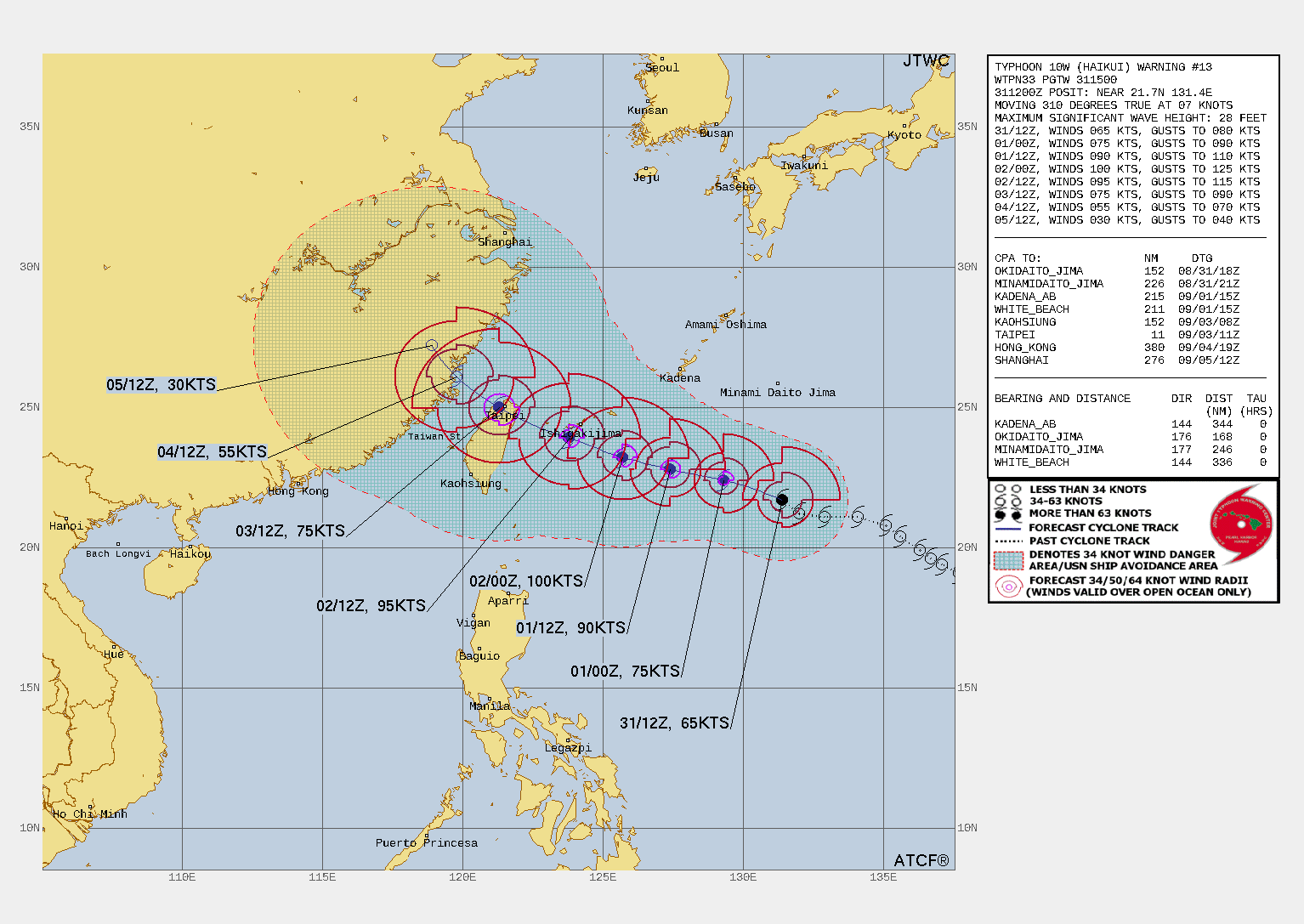
Meanwhile, tropical storm Haikui is forecast to strengthen somewhat, pass Taiwan with a glancing blow and then head towards the Chinese coastline south of Shanghai.
Haikui is only forecast to get to a Category 1 equivalent typhoon, so its wind threats will not be as significant, but rainfall could also overlap with the rain footprint from Saola, making for further flood threats across the region.
The latest forecast map from the JTWC for Haikui can be seen below:
All in, it will be a very stormy few days ahead for China, with the threat of wind and surge damage for regions impacted most directly by typhoon Saola, plus further rain and possible wind damage from Haikui.
While the flood threat for the entire coastal region and inland is seen as significant, with widespread impacts anticipated, but of course far less of them likely to be covered by insurance than the typhoon’s impacts in high-value Hong Kong and the Greater Bay.