Hurricane Ian: Sustained winds intensify to 140mph, as scenario worsens
The major hurricane Ian landfall scenario has worsened considerably after the NHC found the storm has intensified rapidly again, to now pack 140 mph sustained winds as a Category 4 storm on approach to Florida.
We could now be looking at a hurricane landfall with winds of up to 140 mph it seems, with some additional strengthening even possible.
Hurricane Ian has deepened, as we suggested was possible earlier today, with the minimum central pressure now stated at 942 mb.
Some meteorologists are now saying additional deepening is possible as hurricane Ian approaches land, while at the same time the wind field is set to expand, some forecasters say.
This threatens a wider area of stronger and more intense winds, with the potential for more property damage and higher, more impactful storm surge, than modelled scenarios put out yesterday or first thing this morning had considered possible.
Does this mean loss estimates could rise? It’s entirely possible, although a range of up to $40 billion still seems most likely, more on that in our earlier article.
One thing is certain, hurricane Ian is looking more dangerous by the hour as it approaches Florida, with a significant threat to lives and property unfolding.
The NHC cone data shows a 140 mph hurricane right up to landfall, after which it will weaken to Cat 1 as it crosses Florida.
Also of note, one of the models, the German Icon, is now showing a resurgent hurricane Ian moving across Florida, into the Atlantic to strengthen and come ashore around Charleston on the east SC coast. That’s a scenario nobody would want to see unfold, but a number of models now take hurricane Ian across the Florida Peninsula and back into the Atlantic, so can’t be completely ruled out and is something to watch for.
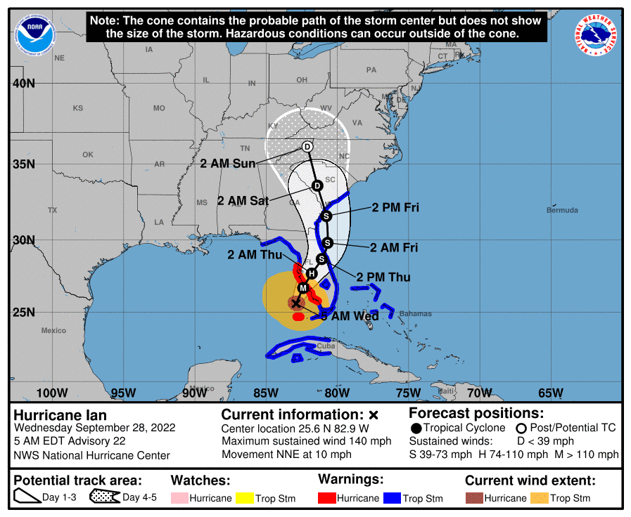
Here’s the latest forecast cone from the NHC:
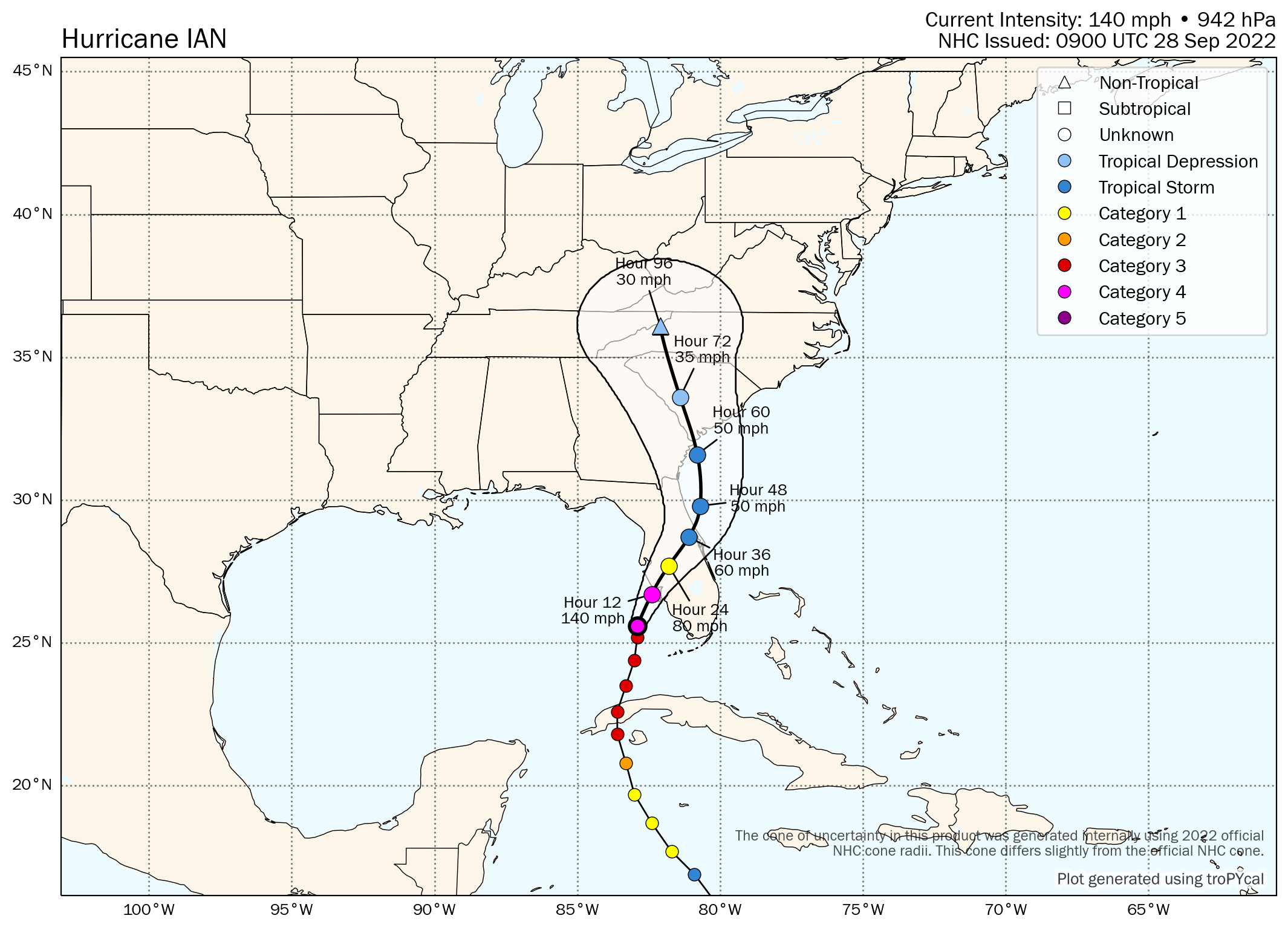
Tomer Burg’s latest forecast map for hurricane Ian, now shows a sustained wind speed of 140 mph up to landfall just to the north of Fort Myers area:
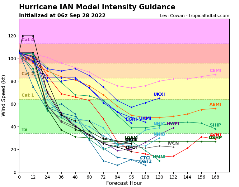
Here is the latest modelled intensity guidance from TropicalTidbits:
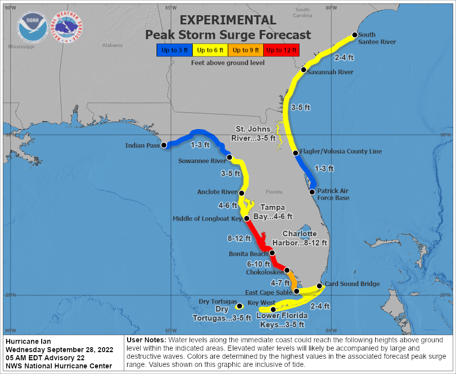
For reference, here also is the latest peak storm surge graphic from the NHC, which now shows a surge of up to 12 foot as possible and widely above 5 foot on the central west coast of Florida’s Peninsula.
Track the 2022 Atlantic tropical storm and hurricane season on our dedicated page and we’ll update you as new information emerges.